S for Sarah Island

SScreen Shot 2019-04-01 at 10.35.03 am

I’m afraid I have to cheat a little here.  Strictly speaking, we weren’t caravanning when we visited Strahan in 1993.   Instead, we caught the Sea Cat across Bass Strait driving our little Daihatsu Applause.  The air conditioning on our larger Ford Falcon was playing up so our two children (aged 13 and 11) sat squashed in the back seat of the small car with an Esky between them.  Not a propitious start to the holiday.  Nor was the seasickness which overtook them both on the voyage across Bass Strait.

By the time we reached Strahan, however, they were quite cheerful at the prospect of staying in a house with their own bedroom.  Up until then, we had frequented caravan parks, staying in caravans and cabins.  Strahan Lodge was an old house situated on a rise overlooking Macquarie Harbour.  It had been moved by truck from the town of Linda, near Queenstown, some years before. 

IMG_20190406_0001
Strahan Lodge in 1993

The children were pleased to meet other similarly aged people and soon a game of cricket was happening on the grassy lawn.  We cooked some fish on the barbecue and got to know some of the other guests.

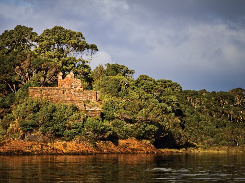
Next morning we boarded the Gorden Explorer at 8.40 am.  Although the weather looked dismal we moved around the ship when weather permitted.  Macquarie Harbour is renowned for the reflections on the tea coloured water but the rain put an end to that.  We passed Sarah Island and were given a brief history of the penal settlement established in 1820. Unfortunately, we didn’t go ashore.  Hopefully, we will go back again to fill in the gaps.

The attraction of Sarah Island was the Huon Pine, a tree perfect for shipbuilding.  The island and nearby harbour shores were covered in it. Over 100 vessels were built during its time as a penal colony. Life would have been miserable for the convicts, cutting timber in chains in the cold and rain. Crowded barracks, frequent floggings and inadequate food would have made it a “Hell on Earth”.

800px-Solitary_cells_on_Sarah_Island
Remains of the Solitary Cells on Sarah Island (attribution Scott Davis)

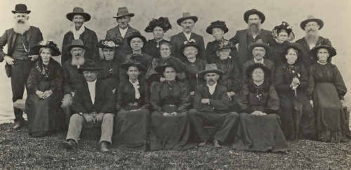
Sarah Island was the penal settlement to which only the worst criminals were sent.  They had committed felonies while they were in prison, or tried repeatedly to escape.  Some proudly wore the scars of 300 lashes.  As a result, the most harrowing and horrifying stories come from that island. One convict, known as Trenham, stabbed a fellow inmate, reasoning that this would get him executed and he wouldn’t have to spend any more time on Sarah Island.


Sarah Island 1
Convict ruins Sarah Island courtesy of Discover Tasmania


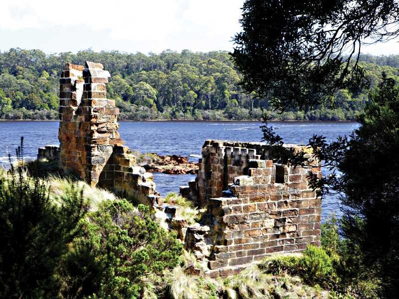
Another famous escape was that of James Goodwin.  He and Thomas Connell carved themselves a canoe and rowed up the Gordon and Franklin Rivers.  Eventually, they had to leave the canoe and continue on foot. Goodwin reached the town of Ouse but Connell was never heard of again.  Fortunately for Goodwin, he was pardoned and given a job with the Surveyor General because he knew so much about the Western Wilderness.

Sarah isalnd 2
Convict ruins Sarah Island courtesy of Discover Tasmania

Alexander Pearce would stop at nothing to survive.  Escaping with seven others, they were all soon starving so drew lots as to who they would kill and eat. Pearce was the lone survivor although some went back to Macquarie Harbour in preference to being eaten. He was recaptured and sent back to Sarah Island. He escaped again with one other inmate who also became a meal for the desperate man.  What happened to him after his capture eleven days later I hate to think.

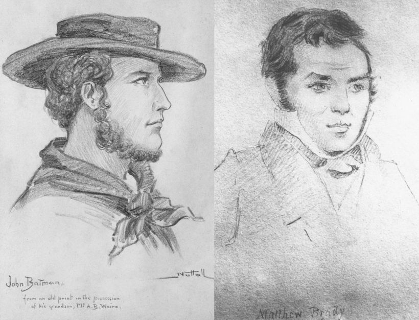
Some people succeeded in their escape, for a while anyway.  Matthew Brady stole a boat and became a bushranger.  Like Ned Kelly he became a folk hero  as he was always well mannered when robbing his victims.  Alas, he was captured in 1826 when one of his gang turned informer in exchange for a pardon.

Brady
John Batman (left) captured the bushranger Matthew Brady (right)


Probably the most amazing escape is the story of “The Men That God Forgot”, the title of a book by Richard Butler.

When it was decided to close the settlement and move the convicts to the newly built Port Arthur prison, not only the convicts were relieved.  Water laden westerly winds brought 100 inches of rain a year.  The Roaring Forties in Winter were fierce and furious.  The soldiers were looking forward to posts in balmy India or more temperate parts of Australia.

William_Buelow_Gould_Macquarie_Harbour
Macquarie Harbour Penal Station, depicted by convict artist William Buelow Gould, 1833 By State Library of New South Wales, CC BY-SA 3.0 au, https://commons.wikimedia.org/w/index.php?curid=42802958


In 1833 all had left the tiny island in Macquarie Harbour except ten convicts who were completing the construction of the last boat, the Frederick.  Of the soldiers left to guard the men, Captain Charles Taw reputedly kept his spirits up with regular doses of rum.  His deputy, Mr Hoy was a more sympathetic man but dogged by severe back pain.  Only five others were left to guard the ten so it is no wonder that disaster struck.

When four soldiers went fishing and with the guns locked away, it was an easy matter for the convicts to take over the ship.  They put the soldiers ashore with a month’s supply of food.  Some of the convicts had enough humanity not to wish starvation on their former guards.

The ship set off for South America while the seven soldiers decided to walk the hundred plus miles to the Van Diemen’s Land Company property at Woolnorth on the far north coast.

The escaped convicts sailed west and made it all the way to Chile, pumping water from the leaking hull as they faced storms and freezing weather.  Finally abandoning ship they rowed the whaleboat to shore and pretended to be shipwrecked sailors. Four of the men were captured and brought back to stand trial on charges of piracy. However, these charges couldn’t stick because the ship had not been completed and had not been seized in open waters, so they were only found guilty of robbery, not piracy.  Consequently, they were not hanged, only imprisoned.

The story has been celebrated since 1994 in the form of a live theatre production “The Ship that Never Was” performed every day in Strahan.

ship01
“The Ship That Never Was” live theatre production written by Richard Davey

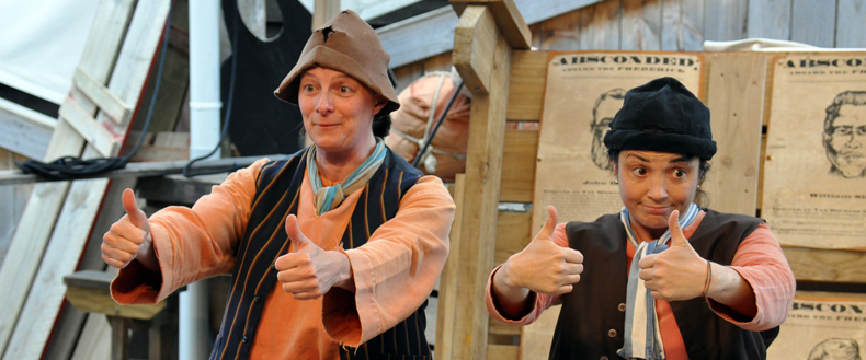
My grandchildren visited two years ago and were very excited to be part of the production which invites members of the audience to participate.


R for Ranges (Flinders)

R

My apologies for the way I have introduced the Flinders Ranges but I felt South Australia was under represented in my blog and it truly is a wonderful state.  Our trip to Wilpena Pound took place in April 2005 with some friends who also owned a caravan. 

I’ll begin our adventure in Quorn, an old railway town built to service the wheatlands.  The wheat failed and the railway closed but the 1880s buildings are still standing.  We stayed overnight in the Quorn Caravan Park and chatted to the new owners who had only been there four months.  They had plans to turn the dry and dusty campsites into lush gardens using recycled grey water.  The local publican, newly arrived from Adelaide, was extolling the virtues of the town.  He said Wilpena Pound wasn’t a patch on Quorn, which lowered our expectations somewhat.

DSCF1147
Quorn Railway Station

On the publican’s advice we diverged from the main road and took the gravel road to Warren Gorge.  He was right.  It was spectacular with red, saw-toothed cliffs towering above a pebbly stream.  The promised yellow-footed wallabies were nowhere to be seen as it was too late in the day.

DSCF1152.JPG
Warren Gorge

It seems that the Flinders are awash with dashed hopes and dreams.   In 1851 Hugh Proby founded Kanyaka Station at the age of 24.  A year later he drowned while attempting to cross the flooded Willochra Creek.  The property continued to function and at one stage employed 70 families, but years of flood and drought caused it to be abandoned by 1888.  A kilometre away from the homestead ruins is a woodshed where 40,000 sheep were shorn in 1864.  All that is left is a damaged land trying to recover from overgrazing, erosion and drought.

DSCF1159
Kanyaka Station Ruins

Nearby Simmonston was surveyed as a town when it was thought the railway would go through it. Part of an old stone wall and cellars from the Teamsters’ Hotel is all that remains today. It is said that this town was surveyed with the view that it would one day become the biggest settlement in South Australia outside of Adelaide. The railway when built went past 20 km’s further east at Gordon and the dreams and money of the investors came to nothing.

The countryside changed as we approached Wilpena Pound.  Cypress pines grew thickly on each side of the road.  On our left the rocky outcrops contrasted to the undulating hills on our right.

After registering at the Visitors’ Information Centre we set up camp next to our friends on a dry and stony site.  On the plus side there were shady trees and a tantalising glimpse of the walls of Wilpena Pound.

DSCF1166.JPG
The walk to Wilpena Pound

The first job of the morning was to book our flights over the Flinders for the next day at 7.30 am. Eager to explore, we followed a walking track alongside a creek, through tall river red gums and pines to Pound Gap.  At the end was a hut built by the Hill family in 1902. When they obtained the lease in 1901 they decided to try farming, something never before attempted so far north in South Australia.  Being in the shadow of some of the highest mountains of the Flinders, rainfall in the pound is a little higher than outside so the Hills were determined to try.

DSCF1167
The Hill’s Family home

The first enormous hurdle was the construction of a road through Wilpena Gap. After building their small hut they cleared the thick scrub around them.  For some years they had moderate success growing crops inside the Pound, but a major flood in 1914 destroyed their access road.  They could not bear to start all over again and sold the homestead to the government.  The Pound then became a forest reserve leased for grazing.

Now a tourist destination, the Pound is a paradise for walkers. Continuing our trek we continued up Wangarra Hill for an impressive view.  From the second lookout you can see the entrance to the Pound.

DSCF1171

The afternoon was devoted to Sacred Canyon.  It turned into a kangaroo spotting and counting competition which our friend won with her keen eyes.  As we walked into the dry gorge we saw engravings of images of animal tracks, human figures and waterholes.  On the horizon the clouds  caused concern over tomorrow’s flight but the next morning dawned clear and bright.

We waited while our red headed pilot,  Andrew, who looked like he should still be in school, took a couple of passengers back to the resort.  He told us the biggest dangers on take off were wandering emus and misplaced kangaroos.

DSCF1186

Our little plane flew over Wilpena Pound, the Theissen ranges, Brachina Gorge and the ABC Ranges.  From the air the Pound looks like a huge crater formed from a meteorite impact.  In reality it began as a slow layering of sediments, starting around 800 million years ago.  Pressure in the Earth’s crust compressed the sediments, folding them up into a mountain range that was once higher than the Himalayas, before erosion brought it down to a more Australian level.

DSCF1177

The indigenous Dreaming story behind the creation of Wilpena Pound, also known as Ikara (‘meeting place’) is different but interesting.  According to the traditional owners, the Adnyamathanha  people, the Pound’s steep walls are actually the bodies of two intertwined giant serpents (Akurra), whose journey from the northern Flinders seriously changed the landscape.  

The two Akurra pursued an old man on the way to a ceremony at Ikara, gorging on people in their path, eventually so full they willed themselves to die. Wilpena’s highest peak,  St Mary’s (1171 metres), is said to be the head of the female serpent.

DSCF1188
The Cazneaux Tree

After our flight with the child pilot we set off on a day trip to explore the area.  The first stop was the Cazneaux Tree, photographed by a man of the same name who won first prize at an International Photographic Exhibition in 1937 with a photograph entitled “The Spirit of Endurance”.  He just so happens to be Dick Smith’s grandfather (for the Australian readers).

Heysen_Droving
Droving by Hans Heyson

From Bunyeroo Valley Lookout we could see  views of Wilpena Pound and  the vast horizontal layers of the Heyson Ranges.

Morning coffee was prepared at Aroona Valley near the hut used by Sir Hans Heyson when he painted some of his best known works.


In the early morning we had seen it from the air.  Now we were travelling through Brachina Gorge.  The highlight for us was a family of emus who walked along the creek bed and then crossed the road in front of us.  It was Dad and nine young ones.  Apparently Mum goes walkabout after the birth. They stopped and drank for a long time from a pool of water – quite a rare sight in this dry countryside.

DSCF1193

It was 1.30 pm and tummies were rumbling.  What a relief to see the Prairie Hotel at Parachilna roll into view.  It is famous for its “Road Kill Grill”.  The men tucked into a mixed grill of kangaroo steak, emu patty, camel sausage, bacon, tomatoes and mashed potato.  The women ordered Caesar salad with emu prosciutto.

DSCF1200

Another 32 kilometres saw us in Blinman, a thriving copper town of 1500 people in 1869. Mining continued until 1918 when the ore ran out. The busiest time for the mine was 1913-1918 with a town population of 2,000.  The population is now 35.

We were heading for home in the late afternoon, passing the Great Wall of China.  There must be thousands of rock formations around the world with that name.  In this case it was a limestone ridge at the top of a range.

Before we left next day we walked to the Old Wilpena Station.  A working station for 135 years, it ceased to raise animals in 1985.  It was a surprise to find it was not in ruins but had a blacksmith’s cottage, shop, stables and harness room, a two storey storeroom, bookkeepers hut and  motor house as well as a homestead.  Known as “Government House”, the homestead is now used as the operational headquarters for the Flinders Ranges National Park. 

DSCF1207
The two-storey storeroom

On the walk back to the camp kangaroos flew off in every direction.  The “big three” of the area are eagles, emus and the elusive yellow-footed rock wallaby.  Overhead the eagles soar in search of their next meal, often ready to eat in the form of road kill.  The single emu dads roam the creek beds with their chicks in tow.  In amongst the  boulders live the rock wallabies, almost extinct in 1992 and now happily increasing in numbers.

There is so much still to see in the Flinders Ranges so one day, hopefully, we will return.

Q for Qantas Founders’ Museum

Q
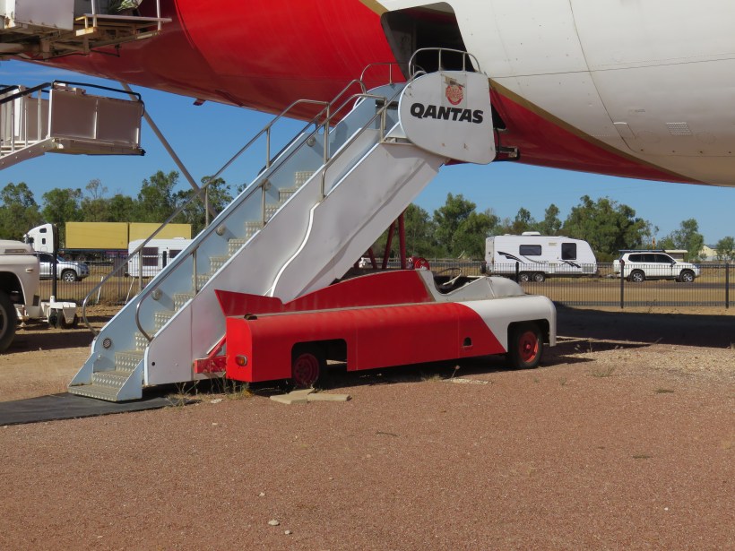
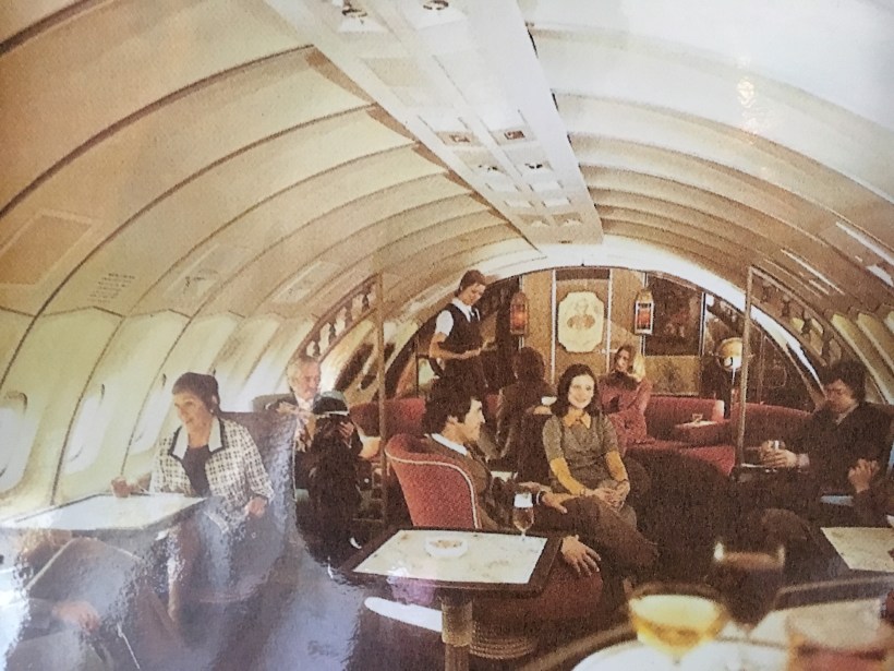
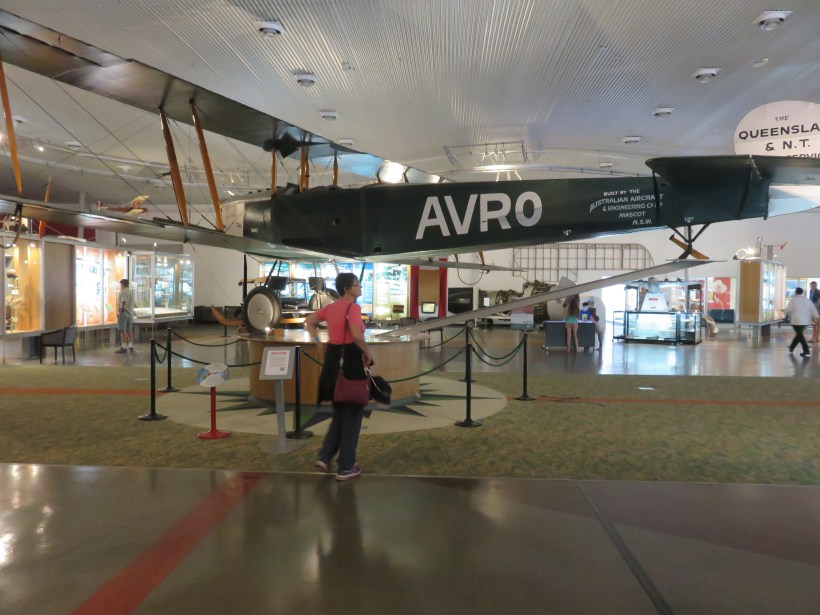
Our first visit to the Qantas Museum was in September 2002.  After settling into our campsite we registered at the Caravan Park Office for a roast dinner followed by a bush poet.  We had two museums to visit in the small town of Longreach.  One was the Stockmans’ Hall of Fame and the other the Qantas Founders’ Museum.  We opted to see the Qantas Museum first.

The Qantas museum had only been completed in March of that year so the exhibits were new and impressive. An eight-minute video narrated by Michael Caton, a much-loved star of the quirky movie, “The Castle” explained his association with Qantas. His mother had worked at the Longreach Qantas Headquarters in its early days. 

Screen Shot 2019-04-01 at 10.30.48 am

It all began in 1919.  World War I was over and the Australian Federal Government was offering £10,000 for the first Australians to fly from England to Australia within 30 days.

Former Flying Corps Officers W Hudson Fysh and Paul McGinness were keen to enter.  They were promised financial backing from a millionaire grazier but while they were searching for a suitable aircraft the grazier died.  So did the money.

Unable to enter the race, the two friends accepted the job of surveying the air race route from Longreach in Queensland to Katherine in the Northern Territory, dropping supplies along the way.

IMG_7587
A quilt in the museum telling the story of the beginnings of QANTAS

Incredibly, they drove 2,179 kilometres across a practically roadless area in a T-Model Ford.  When the tyres became flat they stuffed them with spinifex. The trek completed, Fysh was in Darwin to welcome the winners of the air race, Ross and Keith Smith.

Fysh and McGinnis were both convinced, after their arduous journey, of the need for an air service.  McGinnis made an important new friend when he removed the stranded car of a wealthy grazier, Fergus McMaster, from the Cloncurry River.  His enthusiasm rubbed off on McMaster who convinced some business partners to invest in the new company.

IMG_7584
Early Days of QANTAS mosaic

Arthur Baird became the fourth member of the group.  He had known McGinnis and Fysh in Palestine and readily accepted the offer to join.  His ability to maintain aeroplane engines was legendary.

Starting with two biplanes in 1921, joy flights were offered with the plan to raise money.  If you read my post C for Charleville, you will see reference to the passenger/airmail service which at last gave some financial security to the company.

The first Qantas passenger on a scheduled flight was 84-year-old Alexander Kennedy.  He clambered into his seat on the Armstrong Whitworth, accompanied by Fysh and Baird.  After three attempts to lift off Fysh taxied back to the hangar, hastily transferred everyone and everything to the other machine called old G-AUDE and tried again.  This time they were successful and took off without any further problems.

I was so enamoured of the Qantas Museum that I was somewhat underwhelmed by the Stockmans’ Hall of Fame the next day. Maybe it was the drama of early aviation that captured my imagination.

IMG_8246
Breakfast at the Museum (in our van)

IMG_8257It was 2017 when we called in again, this time to see the two Boeings, a 707-138B and a 747-200 which had landed in 2006 and 2009 respectively.  VH-EBQ is unique in being the only surviving Boeing 747 – 200 with Rolls Royce engines.

Our guide was a rookie – a tour guide in training, but she knew her stuff pretty well.  We learnt a few things about planes we didn’t know before.  For example, what happens to grey water on a plane?  It is expelled into the atmosphere and dissipates.

IMG_8259
Our guide was active on the job

The 707 was the most unusual aeroplane I had ever seen.  It began its career with Qantas but went on to become a luxury charter jet for the rich and famous.

Its interior featured a double bed, a bidet, timber panelling and crystal lamp shades.

IMG_8261
You can see the Lotus and Prado behind the 747

On the 747 we examined the complicated flight deck and observed a black box (which is really orange) before going upstairs to the First Class Lounge.  Only the photographs on the wall showed what it was like in its heyday with well-dressed groups seated around tables drinking cocktails.

IMG_7592

The Avro 504K was the first QANTAS aircraft and was used by the airline for five years. Powered by a 100 h.p. Sunbeam Dyak engine, it was modified to carry up to two passengers as well as the pilot. The original Qantas Avro 504K was sold in 1926.  This is a replica built by two Qantas engineers.  You would have needed goggles and helmets as your head would be exposed to the elements.

IMG_8295
Avro 504K

In 1924, the four-passenger DH-50 was the first purpose-designed airliner used by QANTAS which, until then, used converted military aeroplanes. The DH-50 was the first to have a fully-enclosed cabin.  Can you imagine the difference that would make to the passengers?

IMG_8303 3
de Havilland DH50 Giant Moth “Apollo” (Replica)

From 1926 to 1929, QANTAS built 7 DH-50s in the now National Heritage Listed Hangar in Longreach. In May 1928, the first DH-50 became the first flying doctor aircraft.

There was so much more to see and talk about at the museum but it was time to move on as we still had a long way to go on our around Australia trek.  


P for Point Nepean

P
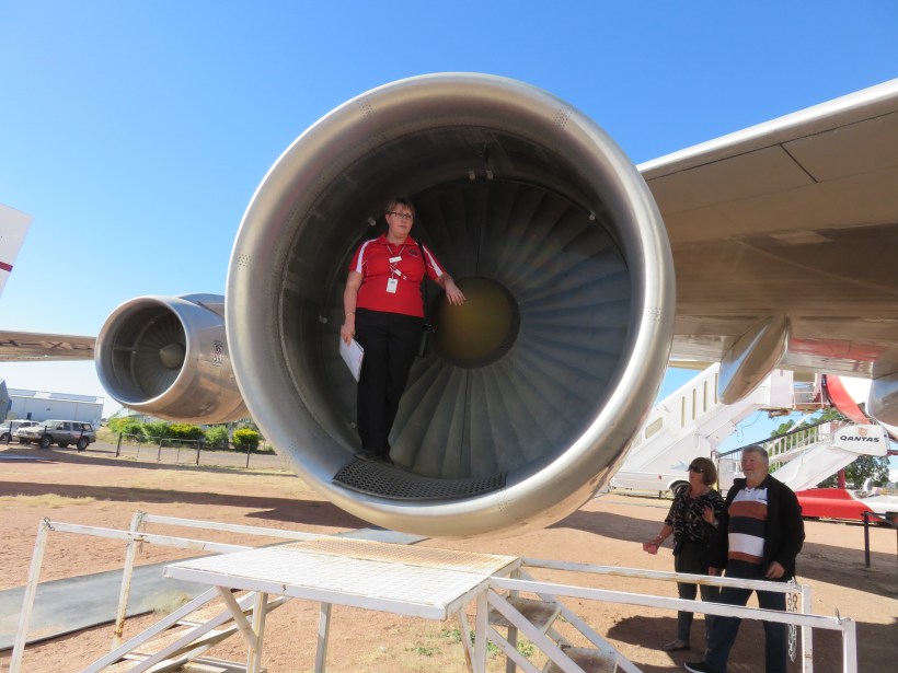
Ever since I wrote in the 2017 A to Z about John’s great-great-grandparents’ experience at the Quarantine Station in Melbourne we have both been keen to see it for ourselves. Here is an extract from the blog:

The ship’s record on the “Percy” shows John aged 39, a miner, Margaret aged 42, Andrew 17, Ellen Curry 14 (listed as a servant), James 12 and John aged 9.
There had been nine deaths on the voyage from suspected typhus, fever and the effects of overcrowding.  The ship was placed in Quarantine at the Sanitary Station on arrival in Melbourne on 17th April 1870 until 25th April.
We noted on the shipping list that four people were detained for another week after the rest of the passengers were towed on board the ship to Hobson’s Bay. Two of those were Margaret and John Curry!  We found from other sources that on the 21st April Margaret gave birth to a baby girl, Margaret.  I wonder what happened to the rest of the family while the parents stayed at the Sanitary Station?

Screen Shot 2019-04-01 at 10.28.32 am

It was Sunday, 10th February 2019 when we arrived in Rosebud, on the Mornington Peninsula. The Foreshore Camping Office gave us two options for our campsite in the bayside town of Rye. As we were reversing onto a flat area in amongst stunted gums and banksias, three men came over and demanded we move as we were on their access road. Moving to the second site before an argument broke out we found a reasonably flat area surrounded by less hostile campers. It seemed that people camped here for months every summer and were very possessive of their piece of dirt.

IMG_2486
Beach at Sorrento

The next day we set off for Point Nepean National Park, not quite sure what we would see. On the way, we passed the historic seaside town of Sorrento, with an ocean beach on one side and Port Phillip Bay on the other. Next town was Portsea was where our former Prime Minister Harold Holt once lived (more about him later). We pulled into the carpark at the Quarantine Station and spoke to the ranger at the Tourist Information Centre.

We were told it is the second oldest permanent quarantine station in Australia (1852 – 1980). In amongst the 50 plus heritage listed buildings, we were able to identify where John Curry and his family would have slept and even where the baby would have been born. We saw the outside kitchens where the family would have prepared their own meals.

IMG_2518
The accommodation used by the Curry family in 1870
IMG_2525
Kitchen building out the back
IMG_2517
Inside the hospital


Standing on the beach we imagined them being rowed ashore from the “Percy” and feeling dry land under their feet after three months at sea. Margaret would have been pleased she was to give birth in a hospital instead of a lurching, damp and smelly ship.

IMG_2523
The beach where they landed

Eighteen years before the Currys arrived, a notorious ship called the Ticonderoga appeared off the heads of Port Phillip Bay, flying the yellow quarantine flag. It had left Liverpool with 795 passengers and 48 crew. During the voyage around 100 passengers died of typhus. As the ship was moored off Point Nepean, the headland was turned into a makeshift quarantine station with 70 more dying after they reached the land.

Michael Veitch wrote the book Hell Ship – The true story of the plague ship Ticonderoga, one of the most calamitous voyages in Australian history, in 2018, and developed a one-person play from it.

IMG_2500
Fumigation of belongings
IMG_2505
Boiler for sterilizing clothes

Construction of the Quarantine Station proper began not long after the Ticonderoga incident. Five large accommodation blocks were constructed in 1858-59, one for sick passengers and four for those unaffected but quarantined none the less. Following Federation in 1901 control passed to the Commonwealth Government. In the period November 1918 to August 1919 almost 12,000 passengers were quarantined here during the worldwide Spanish flu pandemic.

With advances in modern medicine, the need for a Quarantine Station declined and in 1952 the Department of Defence took over some of the buildings. Nowadays it is a popular tourist destination.

IMG_2587
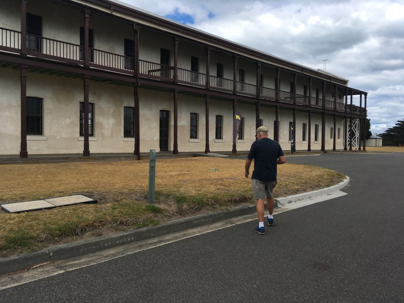
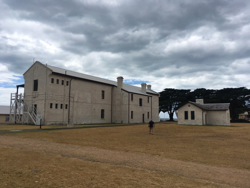
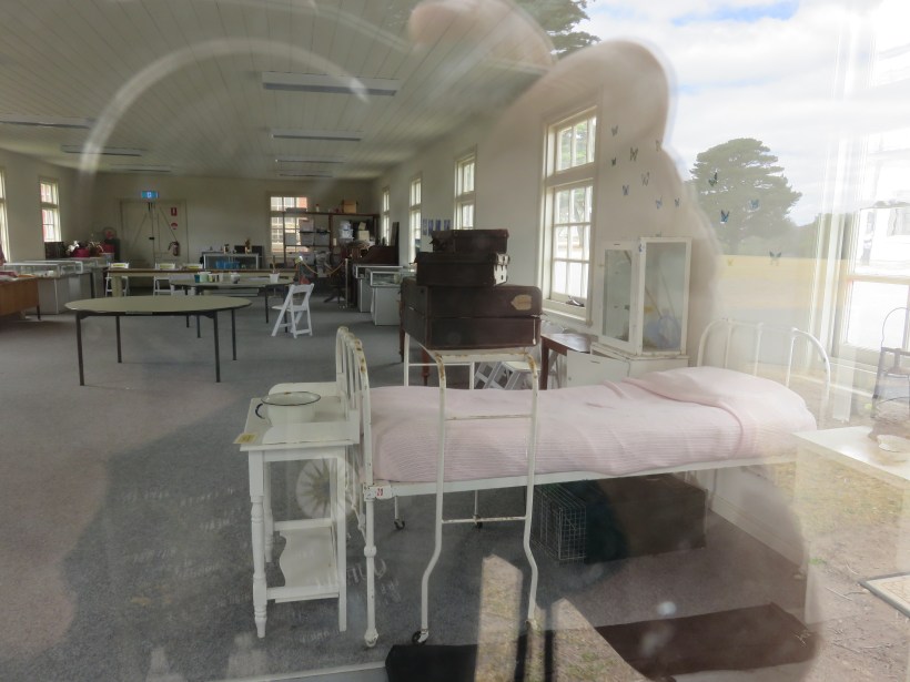
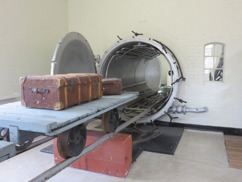
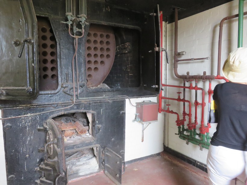
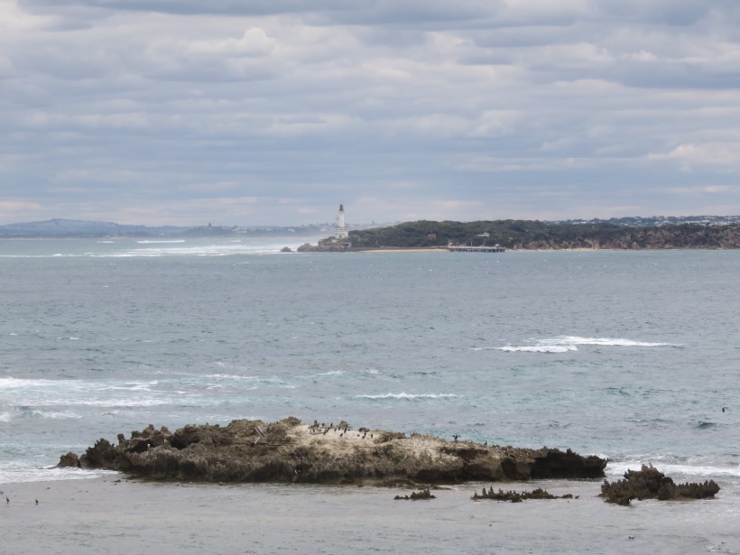
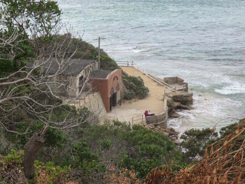
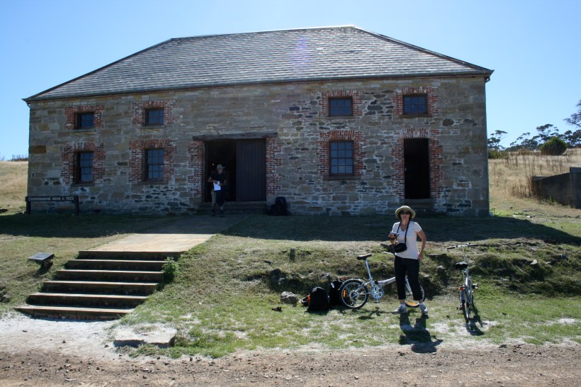
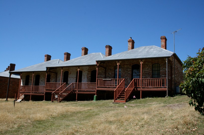
We noticed that a bus left for Fort Nepean every hour. After exploring the Quarantine Station for several hours and eating our picnic lunch (there is no food available there) we paid our $10 and set off on a further adventure. Not knowing what to expect we learnt the fort had been built in 1878 to guard against enemy attack.

Above and below ground we found gun emplacements, barracks, tunnels, ammunition magazines, an engine house and a bomb-proof room. I liked the story about the first shot of the British Empire in WWI coming from here.


IMG_2548
The first shot fired after WW1 was declared
IMG_2566
Fort Queenscliff at the entrance to Port Phillip Bay

On 5 August 1914, the German ship SS Pfalz attempted to escape from Port Phillip. Within minutes of being notified that war had been declared, Lieutenant-Colonel Sandford at Fort Queenscliff gave an order to Lieutenant C Morris, the Fire Commander at Fort Nepean, to “stop her or sink her”. After the Pfalz ignored signals to halt, the B1 gun fired across her bow. The Pfalz then turned around and the crew was arrested at Portsea. I wondered what happened to the German crew after their arrest. Apparently, they were released into the community, with the condition that they register at a police station once a week.

In March 1915 they were interned in camps with other Germans and German Australians.  The officers were sent to the old Berrima Gaol and the crew sent to Holsworthy near Liverpool, NSW. (More on that in Y for Yerrinbool)

IMG_2547
Fort Nepean

In World War 2 Point Nepean made another first. At 1.30am on 4 September 1939, within hours of war being declared, the A1 gun fired across the bow of a ship which failed to identify itself. The ship then identified as the Australian freighter SS Woniora. I would think the crew would have reacted very quickly after that lapse of protocol.

John and I were thinking we would get off the bus at the Harold Holt Memorial and then wait for the next one but our driver anticipated our thoughts. He announced he would stop for fifteen minutes to allow people to walk to the site, take a few photos and wonder, “What did happen to Harold Holt?”

IMG_2582
Cheviot Beach where Harold Holt drowned

It was December 1967. I was in 5th year at High School. We all tuned in to the television to hear the news that our 59-year-old Prime Minister had gone swimming in the treacherous waters at Cheviot Beach and drowned.

Soon, the conspiracy theories began to fly. Had Mr Holt been assassinated by the CIA because he intended to pull Australian troops out of Vietnam? Had he committed suicide? Had he been spirited away by a Russian submarine because he was a spy for Moscow? Or had he faked his drowning – as the former British MP John Stonehouse did in 1974 – to join a lover in the south of France?

Holt
Harold Holt on the beach with his daughters-in-law, circa 1966.
Photograph: Evening Standard/Getty Images

As a Prime Minister, he is remembered not for what he achieved but for getting himself drowned. John was in England at the time and recalls the newspapers featuring Holt and his three bikini-clad daughters-in-law standing on a beach.

Now we were able to stand on a cliff overlooking Cheviot Beach where all those years ago Harold dived into the surf and was swept away, never to be found.

It was the end of another amazing day in our search for the stories that make up the history of our land.

O for Olgas

OKata Tjuta (The Olgas) is part of the Uluru-Kata Tjuta National Park and is often overlooked when considering a visit to the big red rock in Central Australia known as Ayers Rock or Uluru.

IMG_0615
Kata Tjuta

It was way back in 1969 that I first set eyes on the 36 conglomerate domes that make up Kata Tjuta.  All I said in my diary was that after climbing Ayers Rock we travelled to the Olgas, ate lunch and wandered around for a bit.  I can still recall wanting to explore the paths winding in amongst the domes but instead, we all piled into the bus and travelled the 25 kilometres back to the base of Ayers Rock which we then circumnavigated on foot.

Screen Shot 2019-04-01 at 10.23.19 am.png

In 2001 we were back, this time with the A-Van.  Our son was on a university vacation so he flew into Alice Springs, where we met him and travelled the 360 kilometres to the Ayers Rock Campground.  It had changed considerably in the intervening years.  In 1969 we pitched our tents at the base of the rock and had no qualms about climbing to the top.  Now, in 2001, the campground had been moved 15 kilometres from its former location and was part of a larger resort featuring some very expensive accommodation.  Climbing the rock was a hotly debated issue as the wishes of the local Aboriginal people were being taken into consideration for the first time.

Although I had no desire to climb the rock again my son ran to the top and back like a young gazelle and begged us to join him.  At 50 years of age, I found this a lot more difficult than when I was 18.  There are some chains attached to the rock for the first part of the steep climb but when they abruptly stop it as if the rock is saying, “go back”.  There are broken white lines to follow so one doesn’t get hopelessly lost and some steep sections where I required some pushing from behind.

IMG_20190413_0003_NEW
Looking down from Uluru

Getting down again was tricky as it would be easy to go rolling down the side of the rock.  I slid on my bottom in a rather undignified way and was very pleased to be on flat land.  Back in ’69, we signed a visitor’s book at the top of the rock, kept in a covered box.  There was no sign of that 32 years later as the number of visitors climbing the rock had increased exponentially.  Although no thought was given to the Aboriginal significance of the area we were given a lesson in geology by our Teachers College lecturers.  As I wrote in my diary:

Once upon a time, there was a large mountain range in Central Australia which was weathered away completely.  These pieces were deposited as sediment when there was a great inland sea.  The subsequent rock formed was again weathered away over time, leaving Ayers Rock and the Olgas, the latter being composed of much coarser particles.

In 2001 I hoped to explore the Olgas more thoroughly but wildfires totally blocked the road to Kata Tjuta.  We returned to Alice Springs and explored the West McDonnell Ranges before our son flew back home.

It was 2013 when we arrived with our second Toyota Prado and Lotus Caravan. We were travelling with friends and had spent considerable time on the east coast of Australia.  Last stop was King’s Canyon and we were hoping to finally make it to Kata Tjuta this time.  The diary tells the rest.

270px-Mt_Conner,_seen_from_the_road_to_Uluru
Mt Connor Wikipedia

The journey from Kings Canyon to Yulara was just over 300 kilometres but seemed longer because we were keen to get to our new destination. The first stop was Curtin Springs where we bought 50 litres of fuel at the incredible price of $2.26 a litre. An eye-catching purple mountain came into view. It was Mount Connor and is often confused with Uluru by those who first see it. It is a Mesa and the sides flare out about halfway down so it is quite different to The Rock.

IMG_20190413_0002_NEW
Uluru

The first glimpse of Uluru still brought a lump to my throat. The fact that we were playing “I am Australian” on the CD player added to the fervour of the moment.

“We are one, but we are many
And from all the lands on earth we come
We’ll share a dream and sing with one voice
I am, you are, we are Australian”

Songwriters: Bruce Woodley / Dobe Newton

Soon we were passing the various types of accommodation in the Ayers Rock Resort Complex. At the bottom end of the pecking order is the campsite but it quite a pleasant caravan park. There is no grass as it is surrounded by red sandhills but we are parked by a small cement slab which is a bonus.

IMG_1605 2
Ayers Rock campground

After food shopping at the reasonably priced supermarket, we prepared for Happy Hour at the sunset viewing area. We paid our $25 a head park entry fee arriving at four in the afternoon only to find we were almost the only ones there. Eventually, the area filled up and we took photos, drank bubbly and made lots of new friends. Back to the camp for sausages and mashed potato we retired early in preparation for the day ahead.

IMG_0616
Sunset at the Rock

Friday, 26/7/13

It was still hovering around zero at dawn although the forecast was for 23 degrees. We dressed appropriately in shorts and t-shirts with some warm layers over the top. Today was the culmination of a desire at the age of 18 to walk through The Olgas as they were called in 1969. This time I was determined to do the full 7.6 kilometre walk through The Valley of the Winds. It doesn’t sound like much but it was a Grade 4 walk and rated difficult so we were not sure what to expect.

IMG_0619
Valley of the Winds walk

It wasn’t much more difficult than the Kings Canyon Rim Walk but the rocky terrain made walking and climbing harder. The wonderful thing about it was that it was just so different from all the other walks we have done. The variety at every turn made the walk interesting so my advice to all who go to Kata Tjuta is to do the whole walk. Don’t turn back at the second lookout because by then you have done all the hard work.

The last half of the walk is the easy part and is also the best because you are alone, away from the crowds, surrounded by the towering “heads” of conglomerate rock and walking through a green valley full of wildflowers.

IMG_0618
Upside down plant


On the way back we stopped at a viewing platform where we had good views of both Kata Tjuta and Uluru. The most interesting thing I saw was an upside-down plant where the red flowers were under the plant instead of on top, I suppose for protection from the sun. I also learnt that the desert cedar, a funny little tree shaped like a feather duster, is able to channel every drop of water into its root system. When its roots reach the water table below it branches out and becomes a more regular shaped tree

Saturday, 27/7/13

Our last day at Uluru was restful. We drove around the Rock, taking a side trip out to the new 4.5 million dollar sunrise and sunset viewing platform. It is huge, with parking for hundreds of vehicles. We were the only ones there but it must get busier at dawn and dusk. There is a pleasant walk through the dunes with information signs along the way. The views of Uluru and Kata Tjuta are interesting because they can both be viewed together. 

uluru
People climbing Uluru in 2001

I have heard this year that the climb to the top of Uluru is to be closed permanently in November, 2019. This is for many reasons.  One is recognising the cultural traditions of the Aboriginal people of the area and respecting their wishes. Another is safety, as 35 people have died on the rock since climbing records began.

There is still much to see and do in the area without climbing the rock but secretly I still am glad I have done it (twice).

N for New Italy

AtoZ2019N
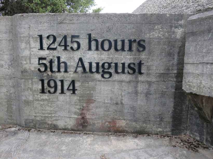
We have been driving north to Queensland as the weather cools down in the Illawarra for as long as we can remember.  The first night is often spent around Woolgoolga on the NSW north coast and then on the second day, we are usually passing New Italy just about morning coffee time.  The first time we stopped here I wandered around the museum reading the story of the early settlers in the area.  I came out with tears prickling my eyes as the enormity of their struggle sunk in.  The wickedness of those who seek to profit from the gullibility of the poor and desperate is no more evident than in the story of the founders of “New Italy”.

Screen Shot 2019-04-01 at 10.20.12 amIt all began in 1880. A Frenchman of noble rank, Charles Marie Bonaventure du Breil, Marquis de Rays was living in genteel poverty after the revolution had deprived him of the family riches.  He decided to regain his fortune by establishing a colony northeast of Australia to be called La Nouvelle France.  A number of impoverished families in northern Italy were attracted by the appealing advertising.  Each settler was to be given twenty acres of land with a four-room house of wood, stone or brick, free transport to the colony and six months of provisions if they paid the required 1800 francs of gold.  For those unable to afford the total amount they could pay 250 francs and achieve ownership of their land after five years.

The French government was suspicious of de Ray’s scheme almost at once.  The Italian government also tried to deter would-be settlers by refusing passports.  Fifty families persevered and made their way to Marseilles where they were transported to Barcelona by sea.  So determined were they to leave that the Italian government issued passports and washed its hands of the whole affair.  On the 8th July 1880, 317 people left Barcelona on the India bound for a colony called New Breton.  On the 14th October, the ship arrived at the new settlement, situated on the shores of New Ireland (near New Guinea).  There was nothing there.  Dense tropical forest grew down to the sea with no sign of houses or arable land.


The new settlers decided to stay on board the ship, going ashore each day to clear the land and plant seeds.  The HMS Beagle called in from Australia to check on their welfare and also a Wesleyan minister from nearby Duke of York Island expressed serious doubts about the future of the settlement. 

The lack of food and tropical climate began to take its toll as the very young and very old began to die.  Once the monsoons set in the position became intolerable and it was decided to sail for Sydney, Australia.  The captain of the ship preferred to sail to Noumea, a French colony, although the settlers protested violently with deaths occurring every day. 

In Noumea, the passengers were given food but they refused to leave the ship, demanding that they go to Australia.  A request was sent to Sir Henry Parkes, Colonial Secretary of New South Wales.  He replied that they were welcome to come to Australia as “Shipwrecked mariners”.  Fifteen of the former settlers stayed in Noumea because of ill health or bereavement but 217 arrived in Sydney on the 7th April 1881.  Funds, food and clothing were collected and the group was housed in the Agricultural Hall of the Exhibition Building in the Domain. 

hiddenitalian1
The New Italy Settlers    Photograph by Joseph Check, courtesy of Mitchell Library, State Library of NSW

Parkes was keen for them to assimilate and so had no qualms about breaking up friendship and family groups.  With little understanding of their need to stay together after such a traumatic experience, it looked as though the group would be dispersed across the state.  The desire to regroup remained strong and luck came their way when an Italian named Rocco Caminotti noticed that land was available in Northern NSW.  He had met some of the New Breton settlers and knew they wanted to be together.  He and Antonio Pezutti chose a selection of gently undulating land, covered with stringybarks, ironbarks and she-oak trees on Bungawalbyn Creek, a tributary of the much larger Richmond River.

pioneer-settlement
Early days in New Italy

First seven and then another thirteen of the Italian settlers arrived at “La Cella Venezia”.  More kept coming while on the other side of the world, de Rays was sentenced to prison. The group became self-sufficient, growing all the food they need to survive.  The men went out to work in the timber industry to bring in much needed cash.  For three decades timber remained the main industry in New Italy. Sugar cane harvesting was another income producer.  A silk industry began in the 1880s but Depression and fire put an end to that enterprise.  Dairying became lucrative in the 1890s and the settlement provided cream to the local butter factory. 

LEC_08-04-2010_EGN_04_LEC_New_Italy_ct677x380
Some of the original residents of New Italy

The once thriving settlement gradually declined as children grew up and moved elsewhere.  In 1933 the school closed and the only remaining residents were the elderly.  The settlement remained inhabited until 1955 but its disintegration can be attributed to the assimilation of the descendants of the original settlers with other Australians, a result of which Sir Henry Parkes would have heartily approved.

M for Maria Island

AtoZ2019M-to find a gaol

in one of the loveliest spots

formed by the hand of nature

in one of her loneliest solitudes

creates a revulsion of feeling

I cannot describe…

William Smith O’Brien

A day trip to Maria Island on a glorious sunny day is a far cry from the various incarnations of this beautiful but blighted island. As my diary shows, we were happy and excited to visit on February 18, 2010.

Screen Shot 2019-04-01 at 10.16.39 am

After arriving at Triabunna on Tasmania’s east coast, we walked around the waterfront to the Information Bureau to check on departure times for the Maria Island ferry.  It leaves at 9.30 tomorrow and we think we will take our bikes.  It will be $50 each plus $10 for the bikes.  We will have to take morning tea, lunch, fruit, water, bikes, helmets and suncream…

Another wonderful day.  The weather was perfect for our trip to Maria Island.  We rode the bikes to the jetty and paid for our tickets. Once on the island, our first stop was the commissariat store which is an attractive brick building containing information about the island.  It is one of the few remaining buildings from Maria Island’s first period of European occupation.

IMG_6612

THE FIRST CONVICT ERA 1825-1832

Fifty convicts arrived with their military escorts.  They were light offenders, many of whom had already completed service on farms.  It was easy to escape as the mainland was only four kilometres away.  Discipline was considered lax but trades and skills were taught in an effort to reform the prisoners.  The closure in 1832 was a result of the success of the more productive and disciplined settlement at Macquarie Harbour.

THE SECOND CONVICT ERA 1842-1850

The Maria Island settlement of Darlington became a Convict Probation Station and most convicts were employed in agricultural tasks. However, in 1847, Darlington was cleared of all convicts to receive 369 prisoners, directly from England, under a new development in the convict system known as Task Work. Early in November 1849, the Irish political prisoner, William Smith O’Brien (convicted of High Treason) was sent to the island. A friendship developed between the Assistant Superintendent-in-Charge, Samuel Lapham, his daughter and O’Brien resulting in scandal, especially when O’Brien made an unsuccessful attempt to escape to the United States in an American whaler.

THE FIRST INDUSTRIAL ERA 1884–1896

On 17 April 1884, an Italian entrepreneur, Diego Bernacchi arrived with a vision to develop the island.  By October 1886 thousands of vines and hundreds of mulberry plants were thriving. The Maria Island Company was floated in 1887 to add agriculture, cement, timber and fishery to the enterprises already undertaken. Signor Bernacchi was resident Managing Director, and Darlington was renamed San Diego. The bustling township of over 250 people had a school, shops, butcher, baker, blacksmith, shoemaker, post office, etc. Then, in 1892 the company went into liquidation and Bernacchi departed for London.

THE SECOND INDUSTRIAL ERA 1920–1930

Bernacchi didn’t give up.  After WWI he was back, forming a small company which resulted in a Cement Works opening in 1924.  He died a year later believing his pioneering dreams were realised.  However, the Great Depression put an end to the enterprise in 1930.

Properties were gradually acquired so that in 1971 the island was declared a Wildlife Sanctuary and in 1972 it became a National Park. 

Back to the diary.

Armed with maps of cycling tracks we decided to head off to French’s Farm and hopefully further on to McRae’s Isthmus and Ocean Beach which was supposed to rival Freycinet’s Wineglass Bay.  The first stop was Darlington Township.  It is a mixture of convict buildings and a number of additions by Bernacchi including the Coffee Palace, the front of which is open to tourists.  What we would have given for a coffee!  Unfortunately, there is no food or drink on the island except water.

IMG_6627
Coffee Palace (I wish!)

We only rode far as the turnoff to Return Point as the road became sandy and difficult to negotiate.  We probably only had about three kilometres to go to French’s Farm.  When the track was not sandy or uphill it was very rocky. 

IMG_6675I didn’t fall off but it was close a few times.  On the way back we stopped for lunch overlooking Four Mile Beach.  At the Painted Cliffs we left the bikes and walked along the edge of the sandstone exposing layers of gold, bronze and cream. The patterns are caused by groundwater percolating through the sandstone and leaving traces of iron oxide. Weathering in honeycomb patterns and undercutting by the action of the sea have created a photographer’s paradise.


On the way back we called into the Darlington township again, this time to read about William Smith O’Brien, a political prisoner from Ireland who lived in one of the cottages in the convict settlement for two years.  It appears he was quite an honourable character, trying to right the wrongs of the political and social mess that was Ireland.

IMG_6678

Back at the Store we ate our apples and considered the next walk/ride.  This was to the Fossil Cliffs.  We left the backpacks in the store and just took our cameras and bikes.  John had brought a heavy bike lock which we didn’t use and cursed it all day.

IMG_6609

The fossil cliffs are made of shell and coral fossils which are 290 million years old.  The cliff exposure is recognised as one of the best examples of lower Permian strata in the world.  Bernacchi used them as a source of material for his cement works which operated until 1930.  From the quarry on the edge of the ocean, we had a good view of Mt Bishop and Clerk and saw kangaroos and Cape Barren Geese.  We could see Schouten Island to the North and beyond that, Freycinet Peninsula.

Returning to the store, we collapsed exhausted on the comfy lounges.  I thought I would just lie there and never get up.

IMG_6635
Loneliness

L for Lark Quarry

AtoZ2019LThe year was 2007.  We were at a friend’s 70th birthday party and I was deep in conversation with a rather eccentric economics lecturer from the University of Wollongong.

“There are two great natural wonders of the world in Australia,” he announced.  “One is the Great Barrier Reef and the other is Lark Quarry.”

We all know of the Great Barrier Reef but I had never heard of Lark Quarry. He told me that 95 million years ago it was part of a great river plain with a rainfall of over a metre a year.  The surrounding forest was lush and green.  The day of the event, herds of small two-legged dinosaurs came to drink at a lake.  There were carnivorous coelurosaurs about the size of chickens and larger plant-eating ornithopods. A huge meat-eating theropod, smaller than a Tyrannosaurus, was stalking the smaller dinosaurs and then suddenly charged.  The stampeding herd left a mass of footprints as they ran to escape.

Screen Shot 2019-04-01 at 10.13.55 am

My first thoughts were, “how come the footprints are still there?”  Sun, wind and rain would normally destroy them.  However, the footprints were made in half-dried mud and then it began to rain so that the lake rose, covering the tracks with sandy sediments.  Subsequent floods buried the prints below sand and mud.  Over millions of years, the sediment layers were compressed to form rock.

A local station manager discovered the Dinosaur Trackways in the 1960s  He thought they were fossilised bird tracks.  However, what he was looking at was the world’s only recorded evidence of a dinosaur stampede.

The day after the party we were heading off with our A-van to Queensland and the Northern Territory with the intention of visiting Kakadu National Park, Litchfield National Park, Darwin and now, of course,  Lark Quarry.

On night two of our journey, we set up in a caravan park, meeting up with a friend who taught at the local high school in a small country town.  It was almost school holidays and she brought along a few other members of staff to the club where we had dinner.  They were feeling cheerful at the thought of the two-week break where they would all return to Sydney for a taste of “civilisation”.

That night was windy and the noise from the palm trees deafened our ears as we went to sleep.  I woke in the early morning, feeling excited that we would be crossing the border into Queensland.  John stepped out of the van and called out anxiously, (polite version) “Where’s the car?”

To cut a long, sad story short, it had been stolen.  After being taken on a joy ride it was stripped and totally burnt out.  We caught a ride with the holidaying teachers to a bigger town where we hired a car and drove home.  The van arrived on a truck a week later.

So it was not until 2017, ten years later, that we finally reached Lark Quarry.  With a different car and a different van we set up camp in Winton and drove the 110 kilometres (65 km unsealed) to the Dinosaur Stampede National Monument.  For 95 million years the fossils were sealed underground but exposure to sun, rain, people and wildlife was taking its toll.  A building was constructed to stabilise the temperature and humidity and to keep water, animals and humans off the fragile Trackways.

IMG_8312

Did it live up to expectations?  Well, it depends on what one was expecting.  I looked at those footprints, large and small,  and tried to imagine the scene 95 million years ago.  Just getting my head around the timeframe was impossible.  That it was there in front of us, recorded for eternity, made our time on earth seem monumentally insignificant.

IMG_8315IMG_7616IMG_7613

K for Kununurra

AtoZ2019K
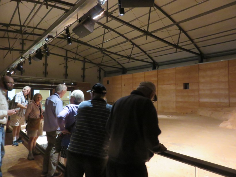
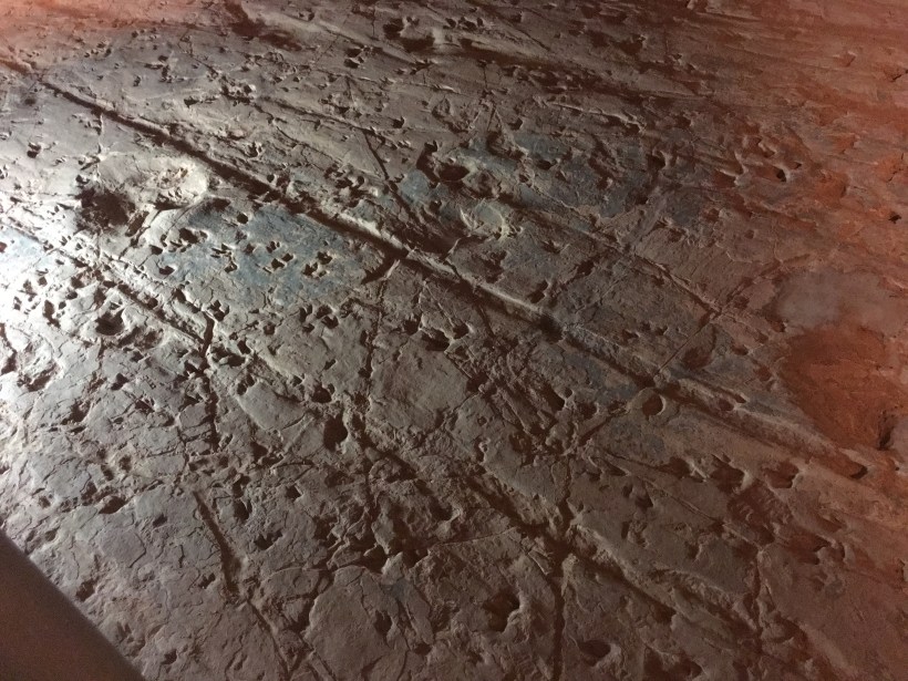
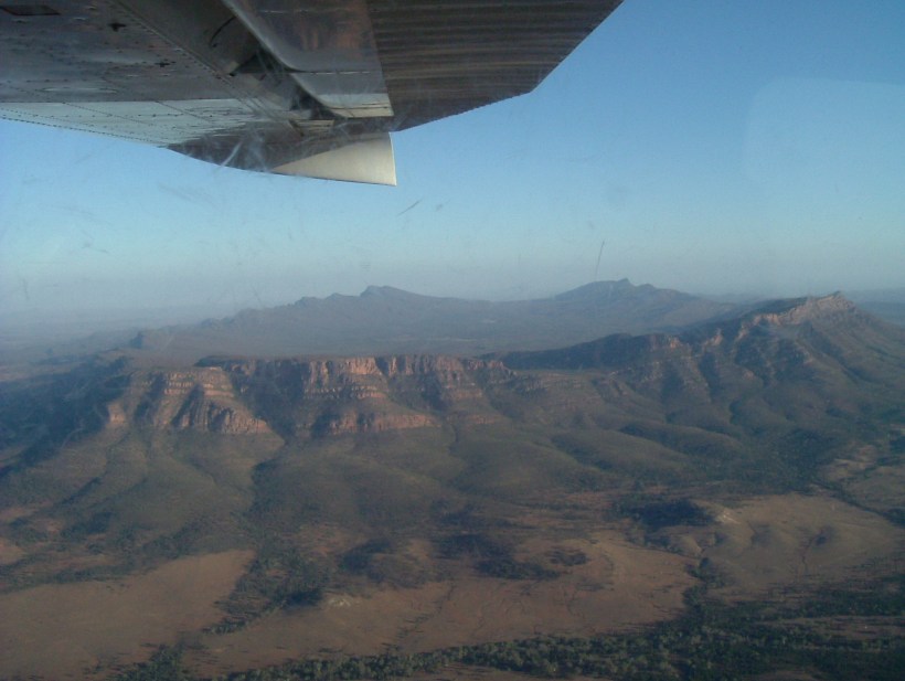
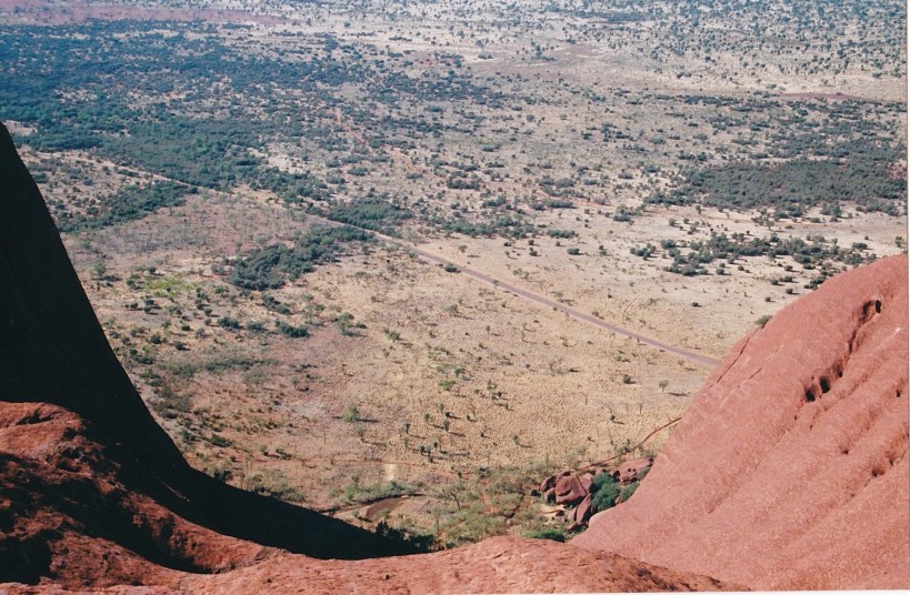
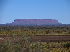
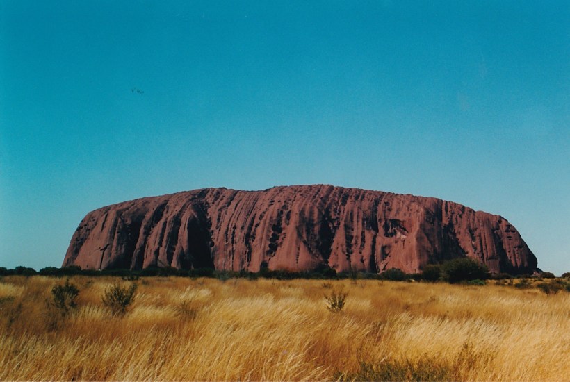
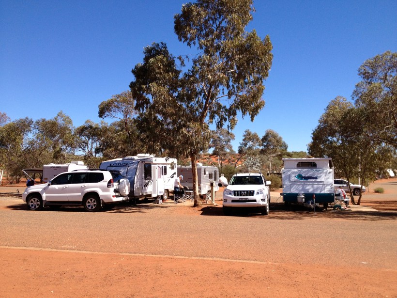
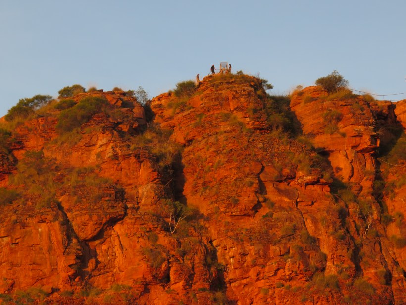
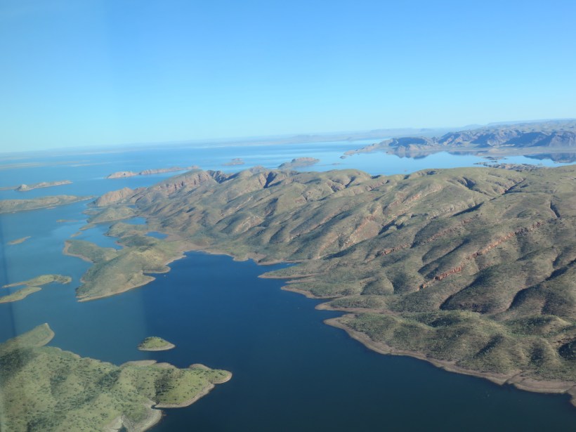
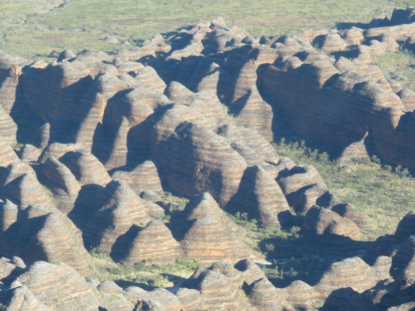
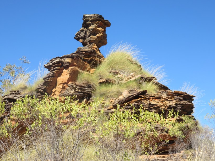
K brings to mind such a list of wonderful places: Kakadu, Katherine, Kings Canyon, Kata Tjuta, Kimberley, Kangaroo Island, Kununurra. It is hard to choose just one.  I will settle on Kununurra.  Strictly speaking, it is part of the Kimberley but so are some of the other places I am going to write about further down the track. Like most Australians, I knew Kununurra was somewhere near Lake Argyle, a massive dam constructed to capture the tropical summer rains and irrigate the crops in the dry winters.  I also knew that various crops had been tried and failed.  Sugar cane, cotton and tropical fruits and vegetables succumbed to pests or could not survive the huge distances required to reach a market.

Screen Shot 2019-04-01 at 10.11.12 am

On our trip around Australia, Kununurra was a totally new experience for us.  Firstly, we had never taken the caravan to Western Australia.  Secondly, I was eager to find out whether the Ord River Scheme had been a success.  Imagine my surprise when I found the most successful crop to date was – Indian Sandalwood!

There are two sandalwood plantations in Kununurra.  My knowledge of sandalwood is limited to a glory box made for my grandmother by her father.  It must have been an old tree to make such a large box because they take many years to grow and are now quite rare.  I didn’t realise the parasitic trees are prized for their aromatic wood and essential oil used in perfumes, cosmetics and medicines.

the-sandalwood-factory
Sandalwood Plantation TFS Corporation

A kilogram of Indian sandalwood oil now sells for about $3,000, or about five times as much as silver, and prices are rising by at least 20 to 25 per cent a year.  The greatest demand is in China and the traditional source of India is unable to keep up with demand.  The trees take 12 to 15 years to mature and in Kununurra have now reached the stage where they can be harvested.

IMG_8526

Before reaching Kununurra we stayed at Lake Argyle Caravan Park.  It was there that we cruised the lake which is 1,000 square kilometres in size and holds up to 10,000 gigalitres.  I made a list of the “big five” in the lake. Fish (catfish and cobbler), freshies (freshwater crocodiles), the agile wallaby, the orb-weaving spider and the jabiru (a bird).  We landed on an island covered in spiders and I assure you we beat a hasty retreat to eat lunch on the boat.  Our guide told us amusing stories of being bitten by a freshie.  They don’t normally bite but she was swinging it by its tail.  The wound got infected and it took a while to recover.  She didn’t recommend that we follow her example.

Back to Kununurra.  The Hidden Valley Caravan Park is surrounded by red cliffs. At sunset they were glowing as of they were on fire.  We climbed Knobby’s Lookout and looked out over the town.  A memorial to three young women, none older than 20, stopped us in our tracks.  They and the pilot had died on a helicopter flight to the Bungle Bungles.  That was where we were going but in an aeroplane, not a helicopter.

IMG_8663

However, before we risked life and limb flying to the Bungles, we drove the 105 kilometres to Wyndham.  Established in 1886 it was a port on the way to a short-lived Gold Rush.  Then it serviced the beef industry and from 1919 the meat works exported beef to Britain.  That closed in 1985.  It was also part of the Overland Telegraph and played a part in WW1. In the 1930s it was the Australian landing point for aviators seeking to establish new solo flying records between England and Australia. In 1935 the Royal Flying Doctor Service (remember John Flynn?) was established in Wyndham.

IMG_8687
Crocodile at Wyndham

Today, Wyndham has a population of just 900 people and operates as a working port, servicing the cattle export industry, the mining and tourism industries and the Ord River Project.

Which brings us to mining.  Pink diamonds! Before the discovery of the Argyle diamond, pink diamonds were a scarce resource, emerging only occasionally from a few mines in the world. The subsequent discovery of a volcanic pipe near Lake Argyle has since changed the world of coloured diamonds. Today, this mine is the source of about 90% of the pink diamonds sold worldwide. However, the rarest of all diamonds is set to become even rarer still as this treasured source is limited! It is estimated that by the year 2020 the mine will yield no more.

A-selection-of-Argyle-pink-diamonds-from-the-2007-tender-shows-a-range-of-color-depth
A selection of Argyle pink diamonds

The day we flew over the Bungle Bungles we saw the diamond mine below us.  The massive Lake Argyle stretched in all directions. 

IMG_8776
Lake Argyle

The beehive-shaped towers of the Bungles finally appeared.  They are made up of sandstone and conglomerate rock deposited 375 to 350 million years ago.  The weathering effects of wind and rain have resulted in an awe-inspiring landscape covering 450 square kilometres.

IMG_8854
Bungle Bungles

The unusual orange and dark grey banding on the conical rock formations is caused by differences in the layers of sandstone. The darker bands are on the layers of rock which hold more moisture and are a dark algal growth. The orange coloured layers are stained with iron and manganese mineral deposits contained within the sandstone.

Back at the camp, we explored our own Mini Bungles.  Known as Mirimar National Park the rock formations are similar to the Bungles but on a much smaller scale.

IMG_8720.jpg
Mirimar National Park

After an exciting week in Kununurra, we left our caravan at the Hidden Valley and drove onto the Gibb River Road with a tent and sleeping bags ready to explore the Kimberley.  More of that later in Z for Zebedee.

J for Jerilderie

AtoZ2019J
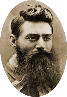
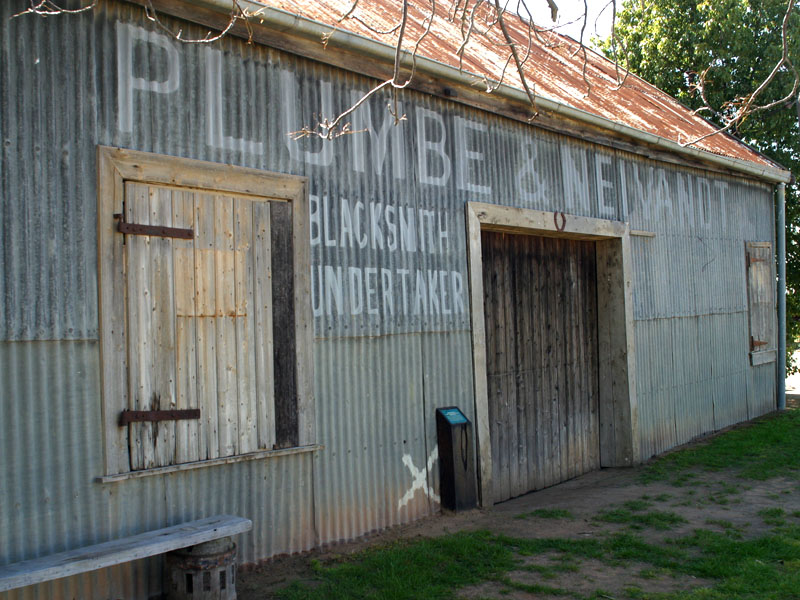
Jerilderie seems to be one of those towns you pass through on the way to somewhere else.  It is 674 kilometres from Sydney, 328 km from Melbourne and 735 km from Adelaide.  We have passed through with our caravan many times on the way to or from South Australia.  Sometimes we have stopped for fuel or to eat lunch in our van.  Rarely have we taken the time to look at the town because we are always on the way to somewhere else or in a hurry to get home.

Screen Shot 2019-04-01 at 10.08.16 am

Jerilderie is probably an approximation of the Jeithi Aboriginal word ‘Djirrildhuray’ which is thought to mean ‘with reeds’ or ‘reedy place’ and probably referred to the banks of Billabong Creek. The first squatters brought their cattle and settled along the creek in the 1840s. From there the town slowly grew, with a few stores, an inn, a post office, school and most importantly for this story, the Bank of New South Wales.

220px-Ned_Kelly_in_1880
Ned Kelly Australian News and Information Bureau, CanberraNational Archives of Austrailia

The gang – comprising Ned and Dan Kelly, Steve Hart and Joe Byrne – arrived in Jerilderie with £1,000 on their heads. They had killed three policemen and successfully robbed a bank. The date was on Saturday 8 February 1879.

During the evening, after dining at the Woolshed Inn, the gang went to the local police station. Ned yelled out that there had been a murder at the inn. The two officers on duty, Sergeant Devine and Constable Richards, rushed out and were grabbed by the gang and locked up in their own cells.

Jerilderie
aussietowns.com


The robbery took place on the Monday. Around 10.00 am Dan Kelly and Joe Byrne rode to the Royal Hotel. At one end of the building, the Bank of New South Wales had its premises. There were about 30 people in the building and they were all herded at gunpoint into the hotel.  Kelly managed to steal £2,140. He also burned records of the mortgages and planned to return the deeds to the locals.

It was while holding up the bank that Kelly passed the famous “Jerilderie Letter” to the teller. It explains his actions and recounts his deep hatred for the Victorian police. It can be read in its entirety at http://www.nma.gov.au/interactives/jerilderie/home.html.  Its most famous quote is:

And are all my brothers and sisters, and my mother, not to be pitied also, who have no alternative but to put up with the brutal and cowardly conduct of a parcel of big ugly fat necked wombat headed, big-bellied, magpie legged, narrow hipped, splay-footed sons of Irish bailiffs or English landlords, known as ‘officers of justice’ or ‘Victorian Police’?

Jerilderie
Post and Telegraph Station        aussietowns.com

Samuel Gill, who owned the local printery and newspaper office, managed to escape and headed off to raise the alarm. Steve Hart rode to the post and telegraph office where he tried to cut the wires preventing the robbery being reported outside the town. Kelly and Hart headed south into the bush. The reward for the capture of the two Kellys, Byrne and Hart was raised to £2000 per individual. £8,000 for all four.

Jerilderie
Jerilderie Courthouse   aussietowns.com

Many of the buildings which existed in 1879 are still standing.  You can still see the Royal Mail Hotel where the Bank of NSW used to occupy one end.  The Jerilderie Courthouse stands opposite the police station where Kelly locked up the two policemen. The tiny Post and Telegraph Station is still there where Hart tried to sever the wires.  The Blacksmith Shop, where the gang had their horses shod, charging it to the police department, is still much as it was 140 years ago.

Jerilderie
Blacksmith Shop   aussietowns.com

What of Ned Kelly and his gang?  They all came to a violent end, which is to be expected, and Ned himself was hanged on 11th November 1880.  He was considered a “Robin Hood” character by many and a cold-blooded murderer by others.  An Australian cultural icon, he has inspired the artistic world in every imaginable way.  Next time I pass through Jerilderie I am going to stop a while and recall that fateful weekend in 1879.